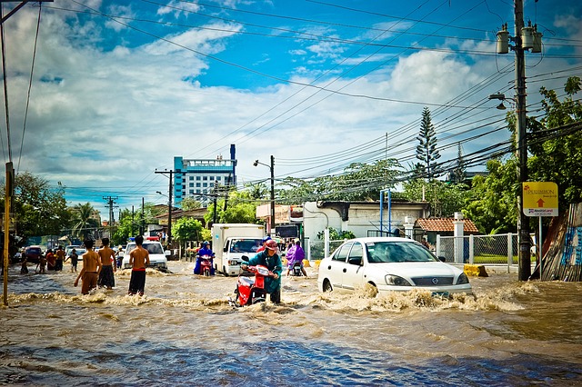
In Sri Lanka, floods usually happen in the Wet Zone. This area is mostly in the southwestern part of the country. It receives a lot of rain, getting over 2,500mm each year. Flooding often occurs during the southwest monsoon from May to September. It also happens in the second inter-monsoon season from October to November. Understanding where and when flooding occurs in Sri Lanka is important. This information helps us prepare for disasters and handle them better.
Understanding Sri Lanka’s Climate System
Geographic Influence on Climate
Sri Lanka’s weather is affected by several key geographic features.
- Location: The island’s spot in the Indian Ocean creates different weather patterns.
- Land Features: The highlands in the center change how rain falls.
- Ocean Currents: The ocean currents nearby affect the monsoon patterns.
- Weather Systems: It interacts with the Inter-Tropical Convergence Zone (ITCZ).
Rainfall Distribution Patterns
Rainfall varies greatly throughout the island in a year.
- Western Slopes: Receive up to 5,000mm every year.
- Southwestern Region: Usually has between 2,500 and 4,000mm each year.
- Eastern Region: Gets 1,750 to 2,500mm every year.
- Northern Region: Lacks over 1,750mm a year.
Detailed Analysis of Climatic Zones
The Wet Zone: Primary Flood Risk Area
The Wet Zone makes up about 23% of Sri Lanka’s land. It has the highest risk of flooding for several reasons.
Characteristics
- Yearly Rainfall: Is over 2,500mm
- Monsoon Effects: Receives rain from both monsoons
- Land Shape: Has steep hills and flat areas
- Population Density: The highest in the country
- City Growth Level: The most advanced area
Major Flood-Prone Districts
In the Wet Zone, some areas have flooding more often.
Colombo District
- Average rainfall each year: 2,400mm
- Major floods happen: 12-15 every ten years
- Main flood time: May to June
- Other flood time: October to November
Ratnapura District
- Average year rainfall: 3,800mm
- Major floods: 15-18 each decade
- High-risk areas: Kalu Ganga basin
- Extra risk: Floods and landslides together
The Intermediate Zone: Transitional Flood Risk
Geographical Features
The Intermediate Zone is an area located between wet and dry places. It has some risk of flooding and comes with unique features.
- Location: It is in the wet zone across a large area.
- Yearly Rainfall: 1,750 to 2,500 mm.
- Seasonal Change: There are distinct wet and dry seasons.
- Land Features: A mix of hills and flat land.
Flood Patterns
- Flash floods happen when there is a lot of rain.
- Rivers overflow in low valley areas.
- There are seasonal floods during the monsoon.
- Built-up areas can experience flooding.
The Dry Zone: Flash Flood Risk Area
Characteristics and Patterns
The Dry Zone can experience severe flooding, despite what its name suggests.
- Rainfall Pattern: Strong but not steady
- Flood Type: Mainly flash floods
- Duration: Short but very strong events
- Impact Areas: Farm areas and old tank systems
Seasonal Flooding Patterns
Southwest Monsoon Season (May-September)
The Southwest monsoon causes lots of rain and floods in some places.
Primary Impact Areas
- Western Province: There is flooding in Colombo and nearby areas.
- Sabaragamuwa Province: Flooding has happened in river areas.
- Southern Province: Coastal flooding and rivers are spilling over their banks.
Flood Characteristics
- Time: It usually takes 3 to 7 days.
- Rainfall Amount: Rainfall averages 100 to 300mm each day.
- Flood Types: There are city floods, river floods, and quick floods.
Northeast Monsoon Season (December-February)
Impact Regions
- Eastern Province: Water from the coast causing floods
- Northern Province: Flooding happens in farm areas
- North-Central Province: Tank systems are overflowing
Flood Characteristics
- Time: 5-10 days
- Rainfall Amount: 200-400mm each day at the highest points
- Flood Types: Flooding from farms and water storage tanks
River Basin Analysis
Major River Systems and Flood Risk
Kelani River Basin
- Length: 145 kilometers
- Yearly Discharge: 5,300 million cubic meters
- Main Flood Areas: Colombo, Gampaha, and Kegalle
- Economic Impact: The highest due to people living in cities
Kalu River Basin
- Length: 129 kilometers
- Yearly Discharge: 7,600 million cubic meters
- Major Flood Areas: Ratnapura, Kalutara
- Flooding Rate: Highest for large rivers
Modern Flood Management Approaches
Structural Measures
Engineering Solutions
- Flood Control Reservoirs: – Bigger capacity
- New gate operations
- Automation of systems
- City Drainage Systems: – Upgrades to pump stations
- Fixing canals
- Using better methods for cities
Non-Structural Measures
Early Warning Systems
- Using Tools:
- Rain gauges that work automatically
- Looking at weather conditions in real time
- Alerts sent to mobile phones
- Get Set as a Community:
- Making plans for evacuations
- Training for emergency actions
- Efforts to raise public awareness
Climate Change Impact on Flood Patterns
Observed Changes
Recent changes in the climate have impacted how floods happen in Sri Lanka.
- Heavier rainfall
- More intense weather events
- Changes in monsoon patterns
- More floods in places that were usually safe
Future Projections
Climate models predict several changes by 2050:
- A 20-30% increase in how strong the monsoon rain will be
- Flood seasons that last longer
- New places where flooding may happen
- A higher risk of flooding in every climate area
Conclusion
The Wet Zone of Sri Lanka often faces flooding, mainly in the southwest areas. Each weather zone has its own flood risks and problems. A combination of natural causes, human actions, and climate change is changing how floods occur on the island. It is important to understand these changes. We must use good management plans to reduce flood damage. This can help protect the communities at risk.
Key Recommendations
- Better ways to watch areas in danger
- Improved city layout and water systems
- Stronger readiness from the community
- Adding ways to change due to climate
- Regular updates of flood risk maps and plans
