
About this list
Sri Lanka is small enough that a two-week itinerary can genuinely cover the south coast, the hill country and one of the ancient capital sites, and large enough that trying to see everything in a single trip means seeing none of it well. This page is a regional index of 74 destinations we think are worth considering, with a short sketch of each — enough to decide whether to plan for it, not enough to plan around it.
What this page is: a starting point. Sketches, not itineraries.
What this page is not: a ranked list. There is no honest way to rank Yala against Sigiriya against Galle Fort; they are different kinds of experiences with different seasons and different audiences. Where a specific decision has a defensible best-for answer — honeymoon destinations by month, ATMs a visitor can actually use, driving permits, hotels by region — Advice.lk publishes that as a separate comparison and links to it below.
How to use it. Scan for places that sound relevant to the kind of trip you want, then plan the specific ones through their own dedicated resources: opening times, entry fees and access notes change frequently and are best verified against the site’s own current page rather than a general index like this one.
Focused Advice.lk guides for specific decisions
- Best honeymoon places in Sri Lanka — regions by monsoon month, since the right coast depends on the month.
- Best hotels in Sri Lanka — where to stay by region and budget.
- Best ATMs in Sri Lanka for tourists — which international-card ATMs actually work.
- Tourist driving permit — the AA procedure for driving here on a foreign licence.
- Digital nomad visa — the new long-stay route.
- How long you can stay on a tourist visa — the current 30/60-day rules.
- All travel resources: /travel/.
A note on the 74 entries below
These entries were written and are gradually being refreshed against primary sources — the site’s own listings, park/reserve authorities, and current published entry fees. Where an entry doesn’t yet carry a “verified” date, treat it as a quick sketch that names the place and gives you a sense of what’s there. Opening hours, fees, permits and access routes should be checked against the destination’s own official page before you go, especially for the national parks and archaeological reserves.
When to go: pick the right coast for the month
Two monsoons cross Sri Lanka in opposite seasons, and they largely decide which region will be dry when. The pattern is not rigid — a wet-season coast still has clear days, and the hills catch rain year round — but it’s the single most useful thing to know before you book.
- Southwest monsoon (roughly May to September). The southwest and central hills get most of their rain. The south coast (Galle, Mirissa, Weligama, Tangalle) is at its wettest; the east coast (Trincomalee, Nilaveli, Arugam Bay) is at its driest and this is peak surf season on the east.
- Northeast monsoon (roughly October to January). The pattern flips. The south and west dry out; the east coast, north and Cultural Triangle get the rain. December to March is the classic peak season for the south coast and hill country.
- Inter-monsoon spells (March–April, October–November) bring thunderstorms and can hit the whole island — usually short and afternoon-timed, but plans should assume some washouts.
- Hill country (Nuwara Eliya, Ella, Adam’s Peak) is cool year-round, wet whenever the monsoon covers it, and best from December through March for both weather and the pilgrimage-season Adam’s Peak trail.
The Advice.lk best honeymoon places guide breaks the same seasonality down month by month if you want a more precise pick.
Cultural Triangle and North Central
The Cultural Triangle covers the three ancient capital regions — Anuradhapura, Polonnaruwa and the Sigiriya/Dambulla belt — plus the surrounding dry-zone national parks. Dry-zone climate: mostly reliable from May to September, wetter from November through February. Archaeological entry tickets are managed by the Central Cultural Fund and can be checked at the site or at the main office in Colombo; multi-site combination tickets exist but pricing changes.
Sigiriya Rock Fortress
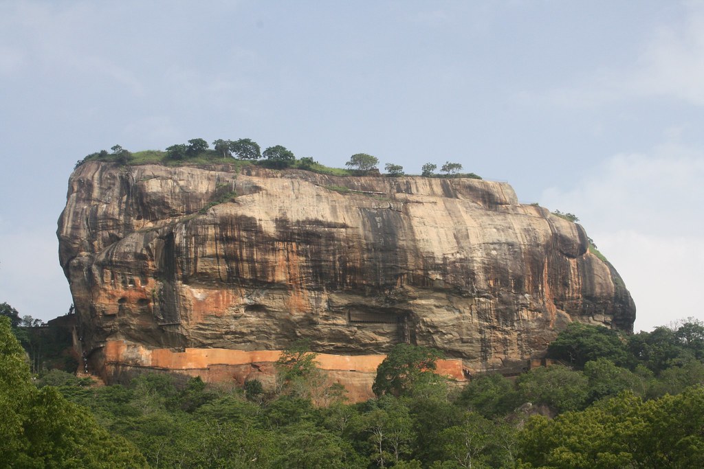 “Sigiriya Rock Fortress” (CC BY-SA 2.0) by Sudharsan.Narayanan
Fifth-century rock fortress rising ~200 metres from the surrounding plain, built as a royal citadel by King Kashyapa. The climb takes 60–90 minutes through the water gardens, past the mirror wall and famous Sigiriya frescoes, up the staircase between the lion’s paws. Start at dawn — the rock traps heat by mid-morning and the tourist volume peaks by 10am. A UNESCO World Heritage Site and Sri Lanka’s single most photographed monument.
Sigiriya Museum
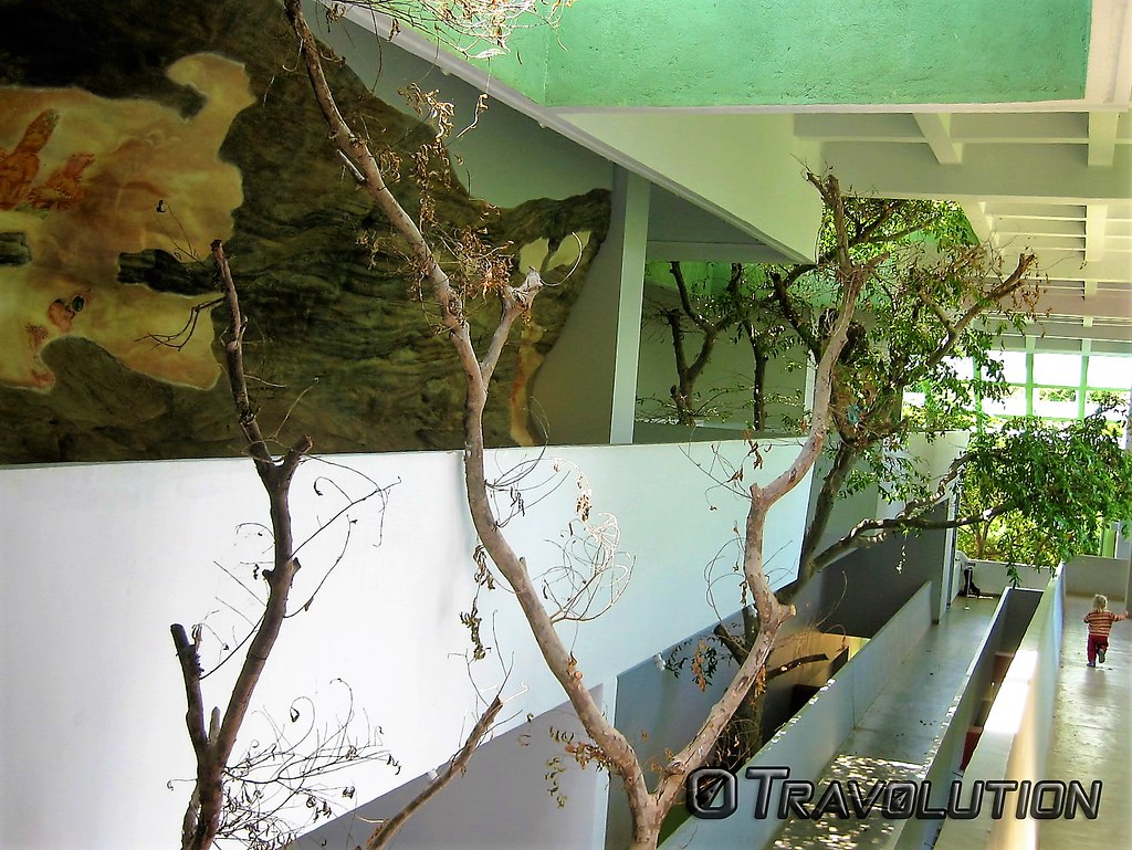 “Sigiriya Museum, Sri Lanka” (CC BY 2.0) by Travolution360
At the base of the rock, the museum contextualises what you’re about to climb: a scale model of the citadel, replicas of the frescoes, and finds from Central Cultural Fund excavations. Entry is included in the standard Sigiriya ticket — worth 30–45 minutes before the climb if you want the history to land, though most visitors skip it in the rush to start.
Pidurangula Rock
Sigiriya’s sister rock, a kilometre north. Cheaper entry, harder climb (a rough boulder scramble near the top), and famously the best view of Sigiriya at sunrise or sunset. Bring a torch if going for sunrise; sensible shoes, not sandals. Popular alternative for travellers who’ve climbed Sigiriya once and want a different angle without paying the full ticket again.
Dambulla Golden Cave Temple
A UNESCO-listed complex of five caves cut into a granite outcrop, in continuous religious use for around two millennia. The caves contain over 150 Buddha statues and painted ceilings that continued to be repainted into the 18th century. A short but steep walk up from the road; shoulders and knees must be covered, shoes removed. Combined nicely with a morning Sigiriya climb — Dambulla is 20km south.
Polonnaruwa Sacred City
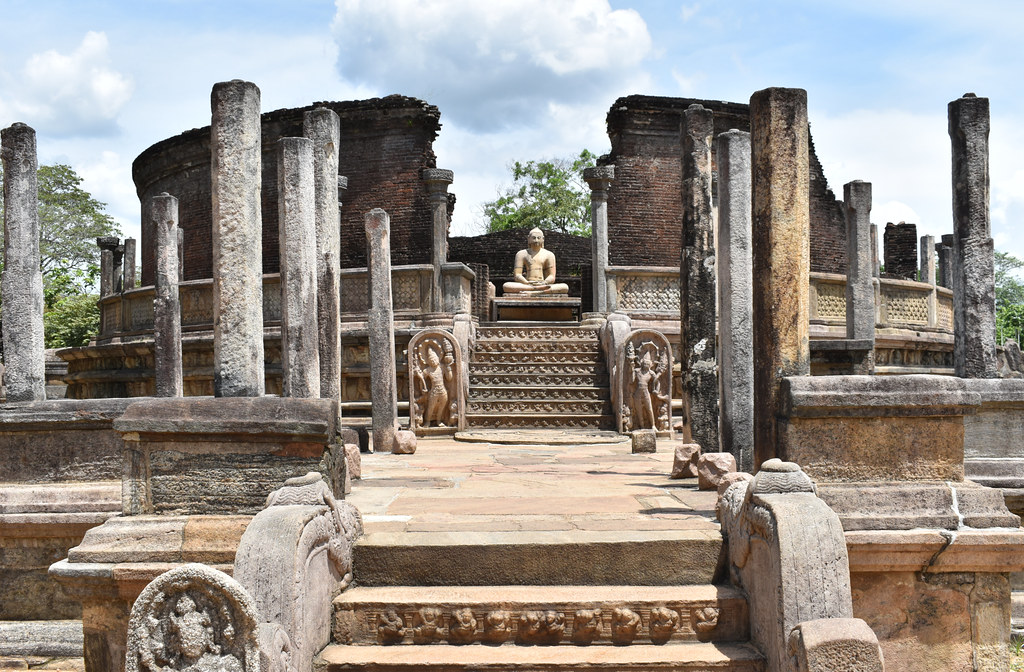 “Polonnaruwa Vatadage” (CC BY 2.0) by Arian Zwegers
Sri Lanka’s second ancient capital (11th–13th centuries), a compact walkable/cyclable UNESCO site of palaces, dagobas, image houses and the Vatadage rotunda. Easier to grasp in one visit than sprawling Anuradhapura — a half-day is enough to see the main quadrangle and the Gal Viharaya rock carvings. Bicycles are the standard way to move between the ruins; several places in the modern town rent them for a few hundred rupees a day.
Gal Viharaya
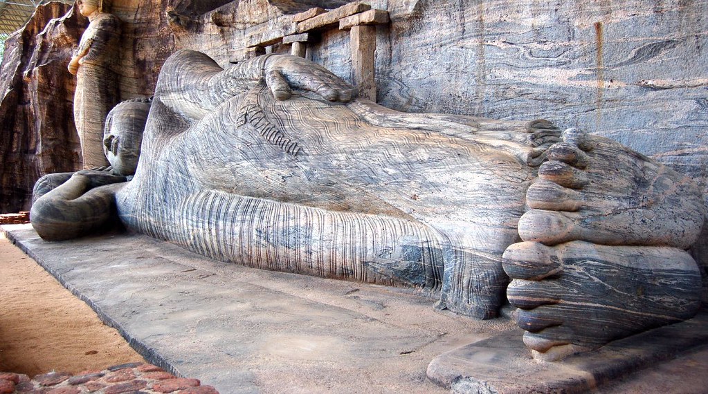 “Gal. Viharaya” (CC BY-SA 2.0) by ashan_algama
Four monumental Buddha figures carved from a single granite face at Polonnaruwa — a standing Buddha, a reclining Buddha, and two seated figures, all 12th century. The most visually striking piece of ancient stonework on the island. Inside the Polonnaruwa Sacred City ticket; usually last stop on a Polonnaruwa cycle.
Ruwanwelisaya
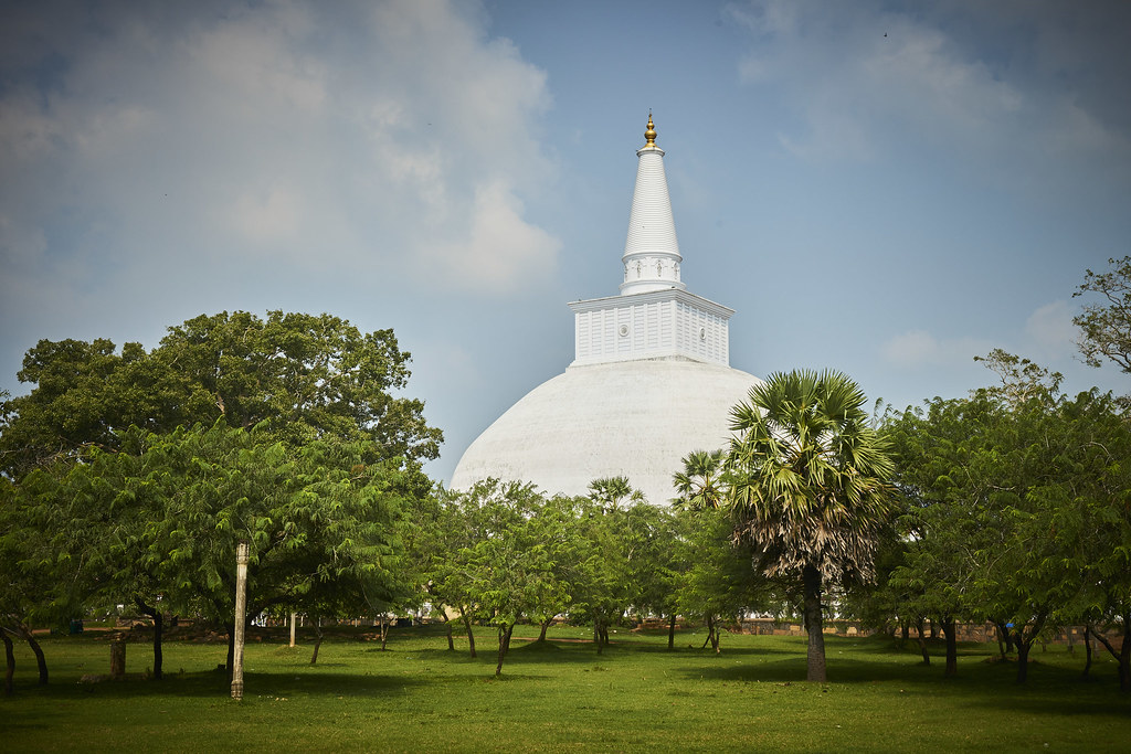 “Ruwanwelisaya” (CC BY-SA 2.0) by oswaId
A vast whitewashed 2nd-century-BCE stupa at Anuradhapura, built by King Dutugemunu and one of the largest ancient structures in Sri Lanka. An active pilgrimage site — white-clad pilgrims circumambulate at dusk when the temperature drops and the stupa is lit. Modest dress required; shoes removed on the sacred terrace.
Mahamevnawa Monastery
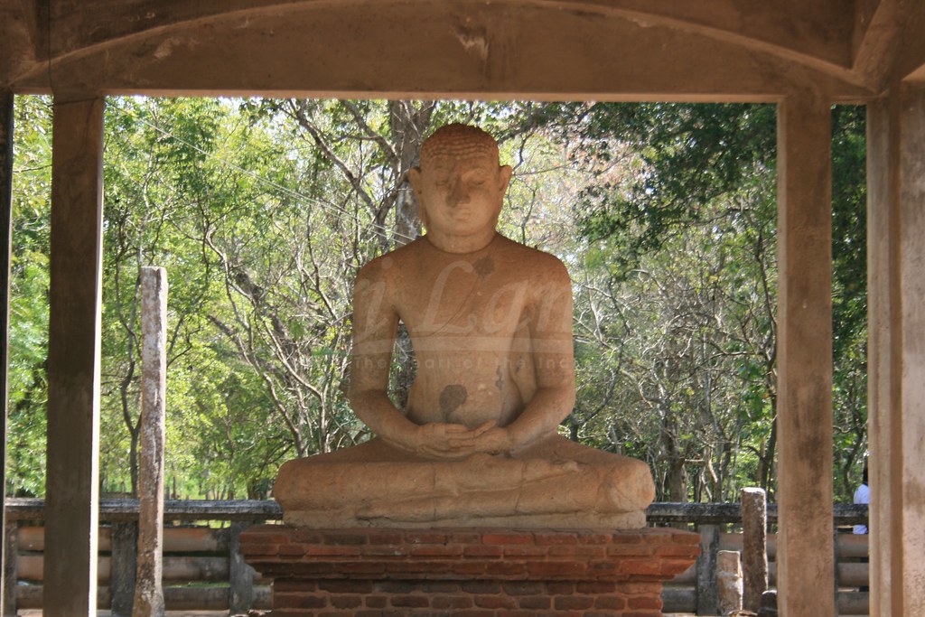 “Samadhi Statue” (CC BY-NC 2.0) by Amal Roshan
Ancient monastic ruins within the Anuradhapura sacred city — meditation platforms, image houses and the famous Samadhi Statue in a small pavilion in the forest. Peaceful even at midday because most visitors head to the more famous stupas. Included in Anuradhapura’s Central Cultural Fund ticket.
Yapahuwa Rock Fortress
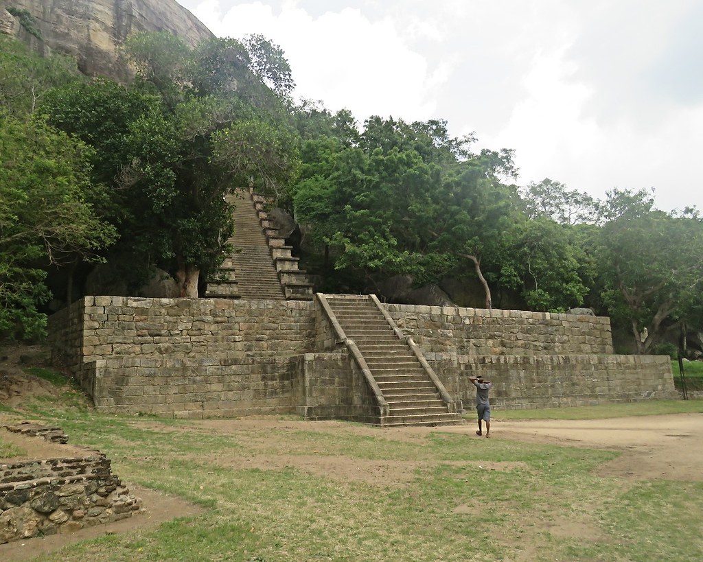 “Yapahuwa Rock Staircase” (CC BY-NC 2.0) by Denish C
Thirteenth-century citadel and briefly a royal capital, halfway between Anuradhapura and Kurunegala. The dramatic ornamental staircase at the summit is the highlight — the lion carvings on it are said to have inspired the lion on the modern Sri Lankan flag. Rarely crowded; good stop for anyone driving between the Cultural Triangle and the west coast.
Minneriya National Park
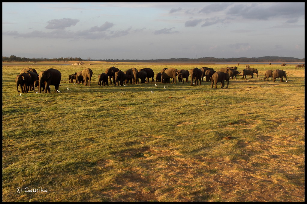 “Elephants @ Minneriya National Park” (CC BY-SA 2.0) by GaurikaW
Best known for “The Gathering” — hundreds of elephants converging on the Minneriya reservoir shoreline during the dry season (roughly July to October). Off-season the gathering shifts to neighbouring Kaudulla or Wasgamuwa, so book through an operator who tracks the herds’ current location rather than assuming Minneriya. Half-day 4WD safaris are standard.
Kaudulla National Park
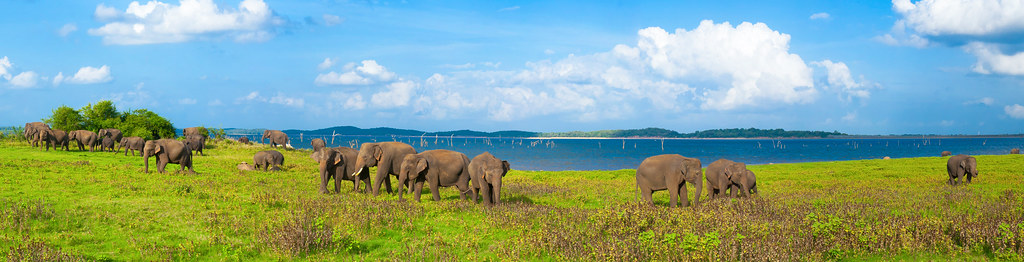 “Elephants in Kaudulla National Park” (CC BY-SA 2.0) by Jonybraker
Minneriya’s neighbour, part of the same elephant-corridor ecosystem. When water in Minneriya reservoir is high (typically November through April), the elephant herds shift here — good operators route safaris to whichever park is currently active. Fewer visitors than Minneriya even on peak days.
Kandy and the central hill country
Kandy is the cultural capital of the central highlands, wet whenever the monsoons cover the hills but cool year-round. The city itself is compact and walkable; several major sights sit within a short tuk-tuk of the lake. Most visitors combine Kandy with Sigiriya to the north or Nuwara Eliya/Ella to the south.
Kandy Temple of the Tooth
The Sri Dalada Maligawa — home to the Tooth Relic of the Buddha and the most important Buddhist site in Sri Lanka. Puja ceremonies are held three times a day; the evening puja (around 6:30pm) is when the relic chamber briefly opens. Shoulders and knees covered, shoes removed, no hats. Free entry to Sri Lankans; foreign visitors pay a ticket. The Esala Perahera procession in July or August takes over the streets around the temple for two weeks.
Kandy Lake
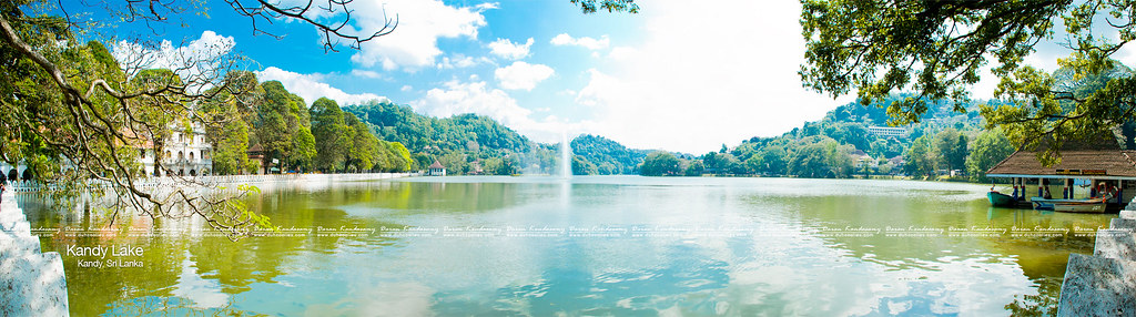 “Kandy Lake” (CC BY 2.0) by Daran Kandasamy
An artificial lake built by the last king of Kandy in 1807, ringed by a walking path directly below the Temple of the Tooth. A gentle 3.2km loop that most visitors do at dawn or dusk when the temperature drops. Water monitors sun themselves on the shoreline; kingfishers and cormorants along the reeds.
Arthur’s Seat, Kandy
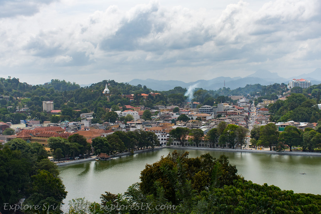 “View of Kandy Lake from Arthur’s Seat” (CC BY-SA 2.0) by exploreslk
A viewpoint on the ridge southwest of the lake, looking down over Kandy town, the temple and the lake in one frame. Reached on foot up a short residential road, or by tuk-tuk. Named after Sir Arthur Havelock, a colonial governor; locals sometimes just call it the “Kandy Viewpoint” and confusion with the officially signposted Kandy View Point up the hill (below) is common.
Kandy View Point
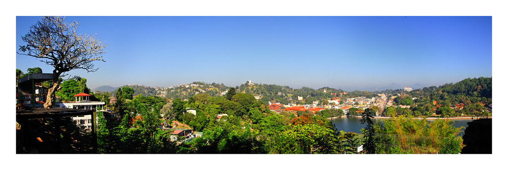 “Kandy Lake and Kandy city aerial panorama” (CC BY 2.0) by Nithi clicks
The signposted city viewpoint above Kandy, higher than Arthur’s Seat and looking down on the whole lake–temple bowl. A short but steep tuk-tuk ride from town; sunset is the classic time. Vendors at the top sell drinks; food options are minimal, so eat before you go up.
Bahiravokanda Vihara Buddha Statue
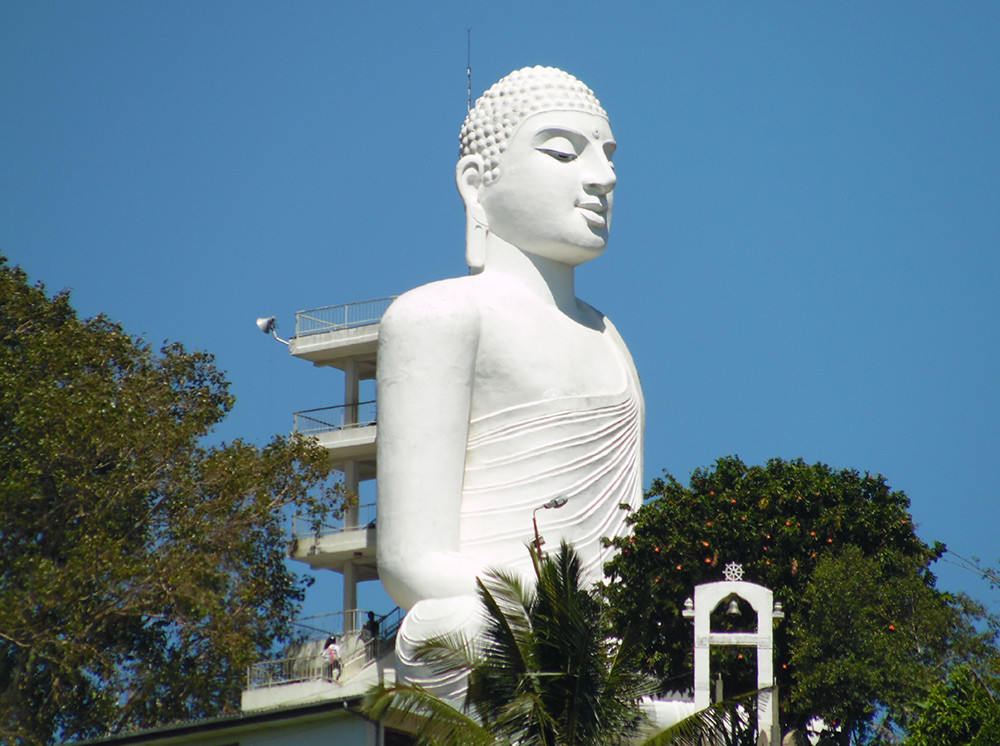 “Bahiravokanda Vihara Buddha Statue” (CC BY-SA 2.0) by ironybored
An 88-foot white Buddha in dhyana mudra, standing on a hilltop west of Kandy town and visible from most of the city. A short climb up from the temple road; you can walk around the plinth for another town-wide view. Best light in late afternoon when the statue catches the sun.
Royal Palace of Kandy
The former palace of the last Sinhalese kings, now the National Museum of Kandy, adjacent to the Temple of the Tooth. Regalia, royal thrones, weapons and everyday objects from the Kandyan kingdom. Small but focused; usually combined with a Temple of the Tooth visit since they share a compound.
International Buddhist Museum
Behind the Temple of the Tooth, a modern museum with dedicated galleries covering the spread of Buddhism through each country in Asia. More text-heavy than most museums here and better for context than for objects. Included in the Temple of the Tooth ticket, so worth 30–45 minutes if you’re already there.
Royal Botanic Gardens (Peradeniya)
A 60-hectare botanical garden set in a loop of the Mahaweli River, 6km west of Kandy. Established in 1821, best known for the palm avenues, the orchid house, and the giant Java fig tree with roots you can walk under. A slow half-day, especially in the cool early morning; carts and tuk-tuks are available inside for anyone who doesn’t want to walk it all.
Udawattakele Forest Reserve
A protected forest reserve directly behind the Temple of the Tooth — rare urban rainforest, once a royal pleasure garden. Monkeys, birds, a small meditation hermitage, and a marked walking loop. Modest entrance ticket at the gate. Best in the morning before the afternoon rain that regularly hits Kandy.
Embekke Dewalaya
A 14th-century wooden temple 25km southwest of Kandy, famous for the intricate carvings on the wooden pillars of the drummers’ hall — dancers, mythical animals, everyday scenes. Rarely crowded, worth combining with the neighbouring Lankatilaka and Gadaladeniya temples on a half-day “three-temples loop” from Kandy.
Knuckles Mountain Range
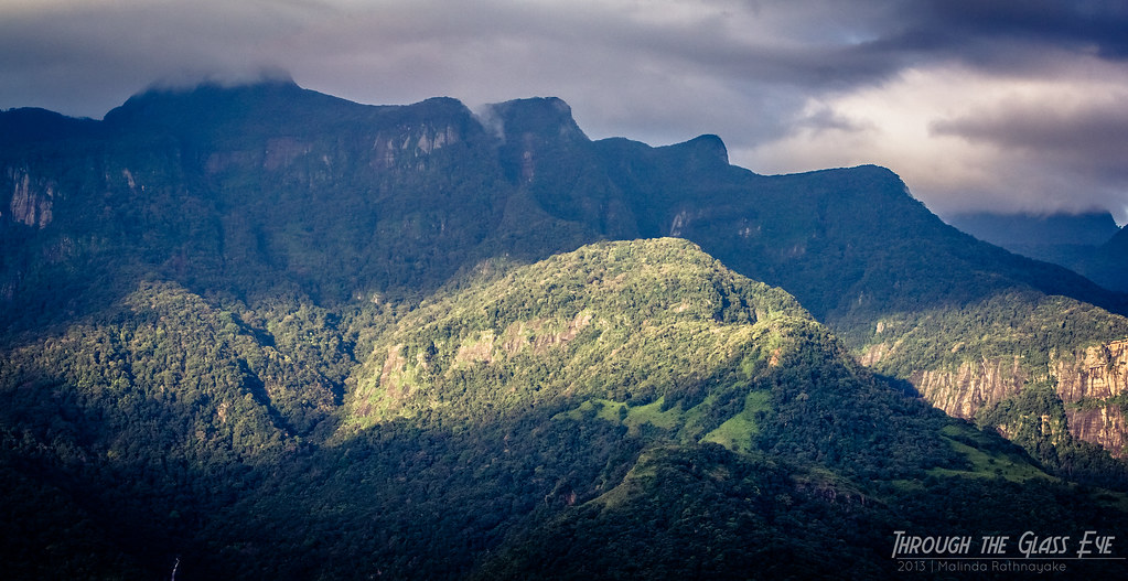 “Knuckles Mountain Range - Sunrise” (CC BY 2.0) by Malinda Rathnayake
A UNESCO-listed range east of Kandy, named for the ridge silhouette that resembles a clenched fist. Multi-day treks through cloud forest, waterfalls and rural villages; day hikes accessible from base villages like Riverston and Meemure. A guide is strongly recommended and, on some routes, mandatory — the paths are unmarked and the weather turns fast.
Adam’s Peak (Sri Pada)
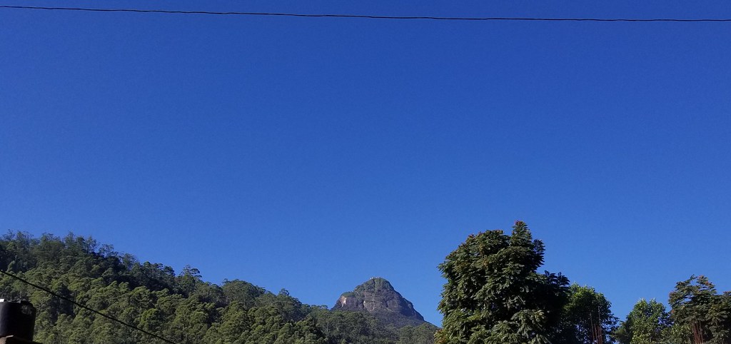 “Adam’s Peak” (CC BY-NC 2.0) by m.gifford
A 2,243-metre conical peak in the central highlands with a rock formation at the summit venerated by Buddhists (as Buddha’s footprint, Sri Pada), Hindus (as Shiva’s), Muslims (as Adam’s) and Christians (as St Thomas’s). Climbed overnight in the pilgrimage season (roughly December through Vesak in May) to reach the summit before sunrise; the trail is lit at that time and busy with pilgrims. Off-season the trail is steep, slippery and dangerous. Two main routes — Hatton/Dalhousie (7km, classic and lit in season) and Ratnapura (harder, longer, unlit).
Dhowa Rock Temple
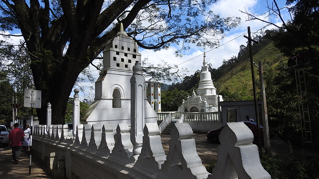 “Dhowa rock temple” (CC BY 2.0) by Dennis S. Hurd
A rock-cut Buddhist temple between Bandarawela and Badulla, with an unfinished 12-metre standing Buddha carved into the cliff face. Rarely visited compared with Dambulla, though the setting is similar — a short walk from the roadside temple. Worth an hour if you’re on the Ella–Bandarawela road.
Mahiyanganaya Sorabora Lake
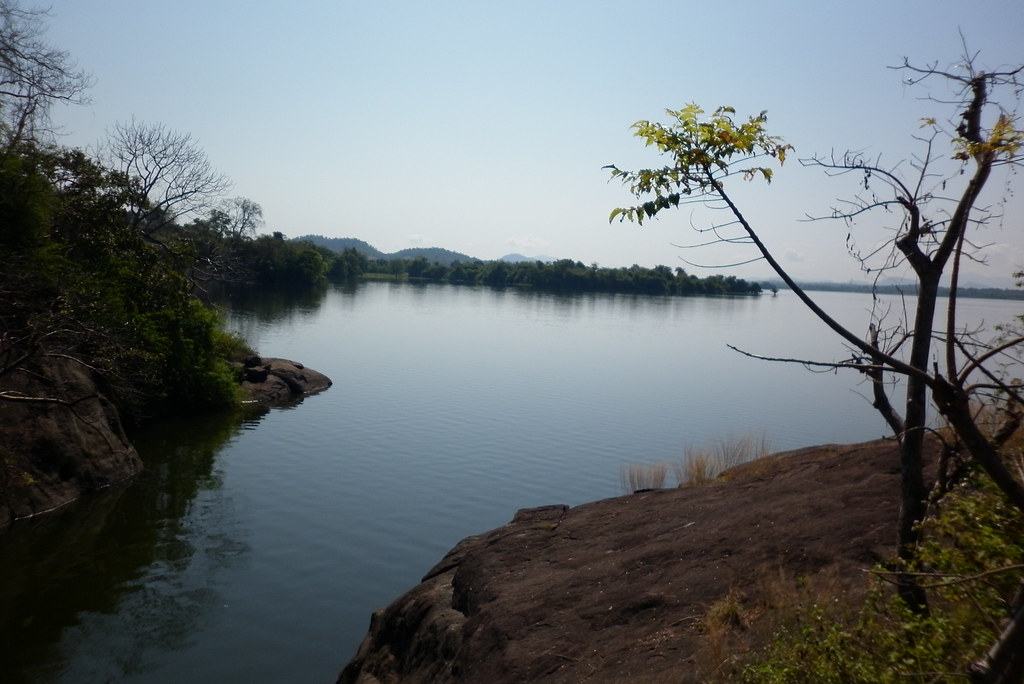 “Sorabora reservoir, Mahiyanganaya” (CC BY 2.0) by wmharsha
An ancient irrigation reservoir dating back over two millennia, near Mahiyangana on the road between the hill country and the east coast. Quiet, wide, and framed by low hills; local boats offer short trips. Combines well with Mahiyangana’s own Rajamaha Vihara — one of the sixteen sacred pilgrimage sites — if you’re passing through.
Rose Quartz Mountain
A pinkish rose-quartz ridge near Balangoda, said to be the largest such deposit in South Asia. Not a curated visitor site — you walk up from the road with a local guide, and there’s no signage or ticket booth. Interesting stop for anyone into geology; underwhelming for anyone hoping for a polished attraction.
Ella, Nuwara Eliya and the upper hills
The Ella–Nuwara Eliya belt is the cool, tea-growing centre of the country. Cloud, rain and mist can appear any month; December through March is the driest and most reliable window. The Kandy–Ella train is one of the classic experiences here; book the second-class reserved carriage in advance if you want a seat.
Ella Rock
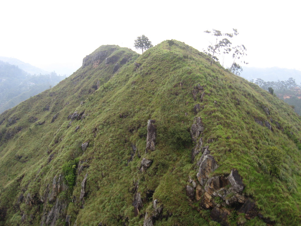 “Ella, Sri Lanka” (CC BY 2.0) by Sasha India
The signature hike out of Ella town — three to four hours round trip through tea estates and pine forest to a viewpoint over the Ella gap and hills toward the south coast. Trail is unsigned in places and locals will offer paid guiding; a downloaded offline map generally suffices in dry weather. Not the same hike as Little Adam’s Peak, which is shorter and easier.
Nine Arches Bridge
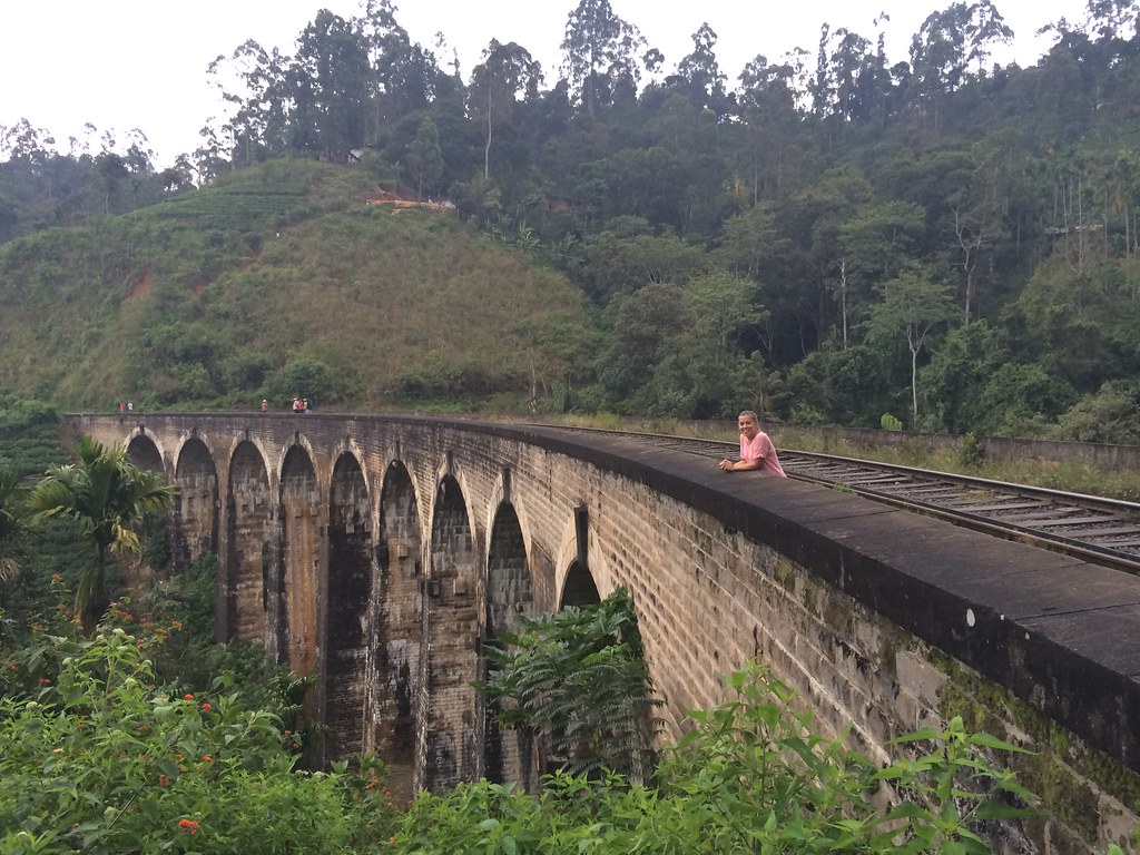 “Ella - Nine Arch Bridge” (CC BY 2.0) by snowflakegirl
An early-20th-century railway viaduct — nine arches, built without steel — arcing through the jungle between Ella and Demodara. Photographed most often from the tea path below, when a train crosses. Locals post the train times outside the nearest cafés; expect crowds for the daytime crossings.
Ravana Falls
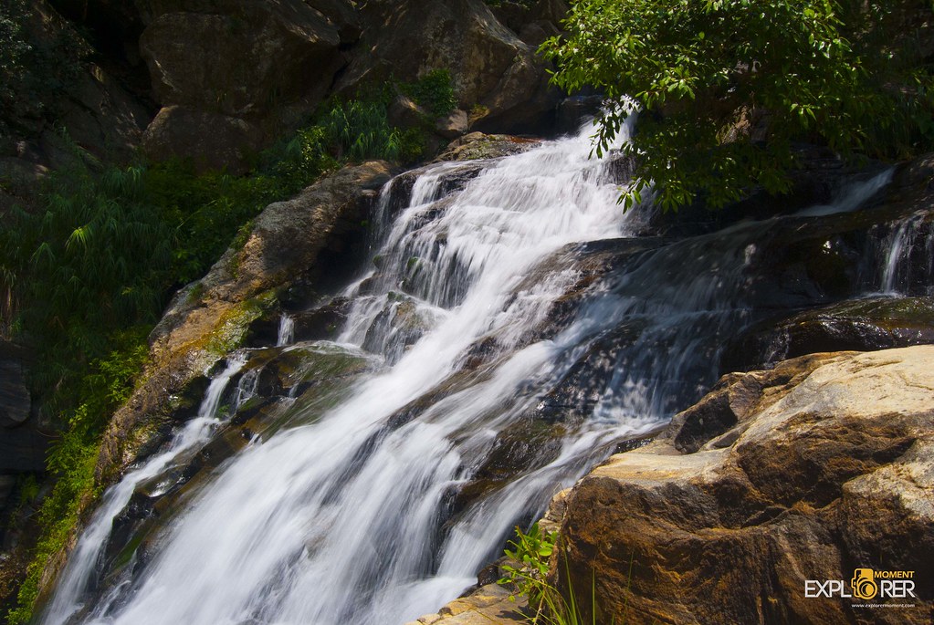 “Ravana Falls” (CC BY-SA 2.0) by Razeen Gaffar
A 25-metre wide waterfall directly beside the road between Ella and Wellawaya — no walking required, just stop the tuk-tuk. Named after the Ramayana king Ravana, whose cave (a short scramble away) is claimed as the hiding place for Sita in local legend. Fullest during and just after the SW monsoon.
St. Clair’s Falls
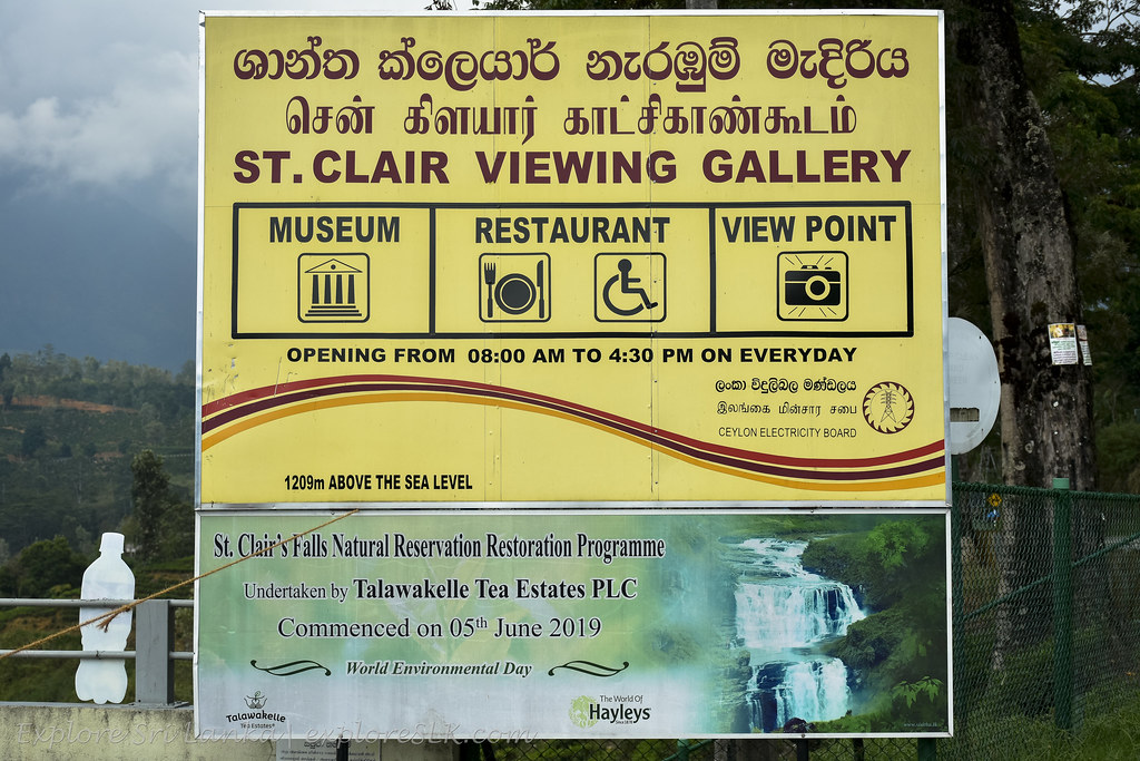 “St. Clair’s Falls” (CC BY-SA 2.0) by exploreslk
The “little Niagara” of Sri Lanka, near Talawakele in the upper tea country. Twin falls dropping through a wide sheet of tea-covered hillside — best photographed from the roadside viewpoint on the Nuwara Eliya road. Flow depends heavily on rainfall and, in dry months, on releases from the Upper Kotmale hydro project upstream.
Horton Plains National Park
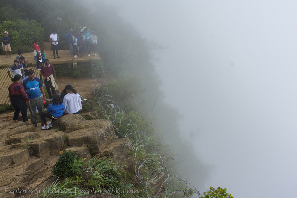 “Horton Plains National Park” (CC BY-SA 2.0) by exploreslk
A high-altitude plateau at ~2,100m, rare montane grassland and cloud forest inside a national park. The 9km circular hike takes in the two World’s End viewpoints, Baker’s Falls, the Chimini pool and stretches of upland cloud forest. Cold and exposed at altitude; dress for hill weather. Entry ticket and mandatory guided walks in some sections.
World’s End
The signature viewpoint on the Horton Plains circuit — a sheer 880-metre drop off the southern escarpment of the plateau, with a smaller 275-metre “Little World’s End” a short walk further along the trail. Start the loop before dawn: the cloud almost always rolls up over the escarpment by 9–10am and the view disappears for the rest of the day. Reach the gate itself by 6am to be at the viewpoint in time.
Colombo, Kandy road and the west coast
Colombo is the commercial capital — dense, busy, low-rise stretching along the coast. Most visitors stop for a day or two, use it as an arrival/departure base, and combine it with the western beaches south of the city (Panadura, Beruwala, Bentota, Hikkaduwa) which are drier from December through March.
Galle Face Green
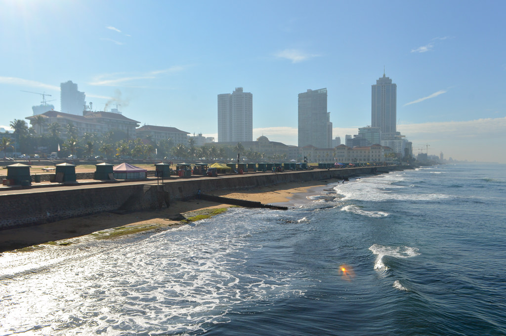 “Galle Face Beach” (CC BY 2.0) by Francisco Anzola
A half-kilometre seafront promenade in central Colombo, framed by the Galle Face Hotel and government buildings. Locals gather at dusk for kite-flying, hoppers from the street carts, and the sea breeze. The single best “arrival evening” in the city.
Gangaramaya Temple
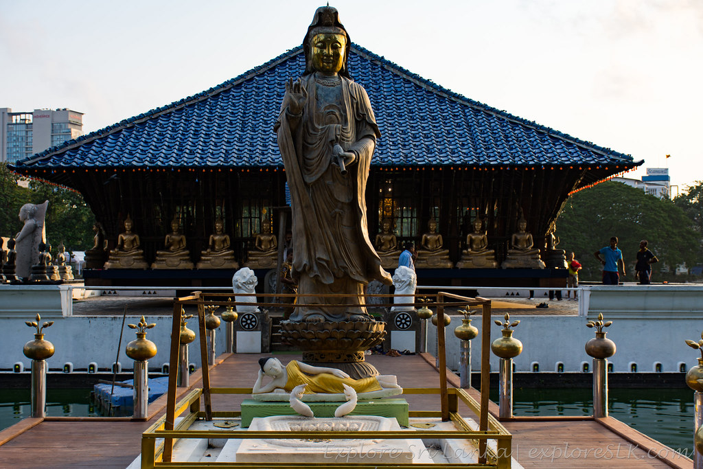 “Gangaramaya temple Seema Malakaya” (CC BY-SA 2.0) by exploreslk
An eclectic 19th-century temple in central Colombo, part active shrine, part museum of Buddhist artefacts collected from around Asia. The floating Seema Malakaya meditation hall on the neighbouring Beira Lake is by the same architect (Geoffrey Bawa). Small modest-dress ticket; usually easy to combine with Beira Lake in a Colombo walk.
Beira Lake
 “Lake Beira - Pavilion” (CC BY-SA 2.0) by mikecogh
A colonial-era lake in the heart of Colombo, ringed by office towers and dominated by the Seema Malakaya. Swan-shaped pedal boats operate at the northern end. Best in the late afternoon when the light is soft on the water and the offices start emptying out; less appealing at midday when there’s no shade.
National Museum of Colombo
 “National Museum of Colombo” (CC BY 2.0) by yooperann
Sri Lanka’s oldest and largest museum, in a whitewashed colonial building in Cinnamon Gardens. The regalia of the last Kandyan king, an important stone-tools collection, and the definitive gallery for pre-colonial art. Two to three hours; combine with Viharamahadevi Park across the street.
Sri Lanka Cricket Museum
Small, focused museum tracing the history of cricket in Sri Lanka from the colonial clubs of the 19th century to the modern Test era. Photographs, kit and memorabilia. Interesting for cricket fans; niche for everyone else. Check current opening hours before visiting.
Independence Memorial Hall
 “Independence Memorial Hall” (CC BY-NC-ND 2.0) by Mabacam
A national monument commemorating Sri Lanka’s independence from British rule in 1948. Modelled after the Magul Maduwa audience hall of the Kandyan kings; the surrounding Independence Square is a popular joggers’ and evening-walkers’ park. Free to visit; a small independence museum sits underneath.
Viharamahadevi Park
 “Viharamahadevi Park, Colombo” (CC BY-SA 2.0) by cat_collector
Colombo’s largest urban park, opposite the National Museum. Jacaranda, temple trees and a large golden Buddha statue at the centre. A useful decompression stop mid-Colombo-walk; playground and paddle boats for families.
Pettah Market
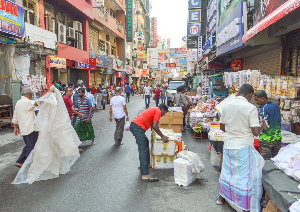 “Pettah market” (CC BY 2.0) by Francisco Anzola
Colombo’s wholesale bazaar district — narrow streets grouped by trade (fabric on one, electronics on another, spices on a third). The most sensory-overload part of the city; visit in the morning when the produce is fresh and the heat manageable. Watch bags in crowds.
Red Mosque (Jami Ul-Alfar)
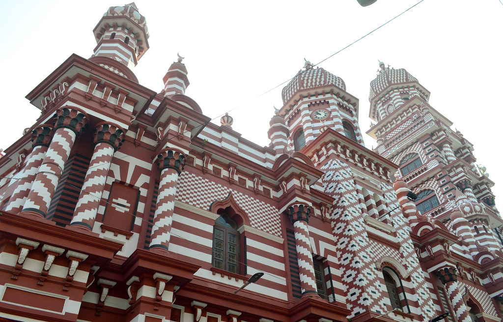 “Red Masjid” (CC BY 2.0) by Francisco Anzola
The striped red-and-white 1908 mosque at the heart of Pettah, one of the most photographed buildings in Colombo. Non-Muslim visitors welcome outside of prayer times; long trousers and covered shoulders required, women given a robe at the door. Small donation appreciated.
St Anthony’s Church
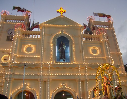 “St. Anthony’s Church” (CC BY-NC-SA 2.0) by HumanityAshore
Kochchikade — a major Roman Catholic shrine church in northern Colombo, target of one of the 2019 Easter Sunday attacks and rebuilt and reopened afterwards. Feast day (13 June) draws large crowds. Modest dress; open outside mass times.
Commonwealth War Cemetery
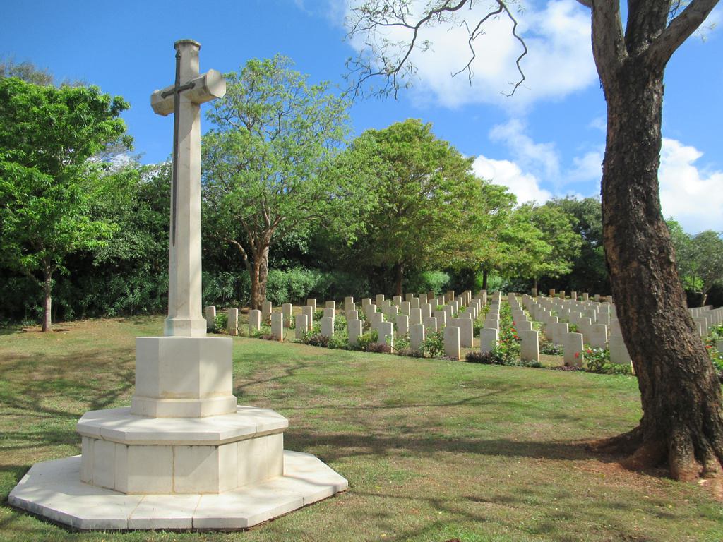 “Commonwealth War Cemetery” (CC BY 2.0) by D-Stanley
Two Commonwealth War Graves Commission cemeteries in Colombo — Liveramentu (Borella) and Kanatte — commemorating Second World War servicemen. Quiet, well-maintained, free to enter. Of specific interest to visitors with a family connection or an interest in the wartime Indian Ocean theatre.
Dehiwala Zoo
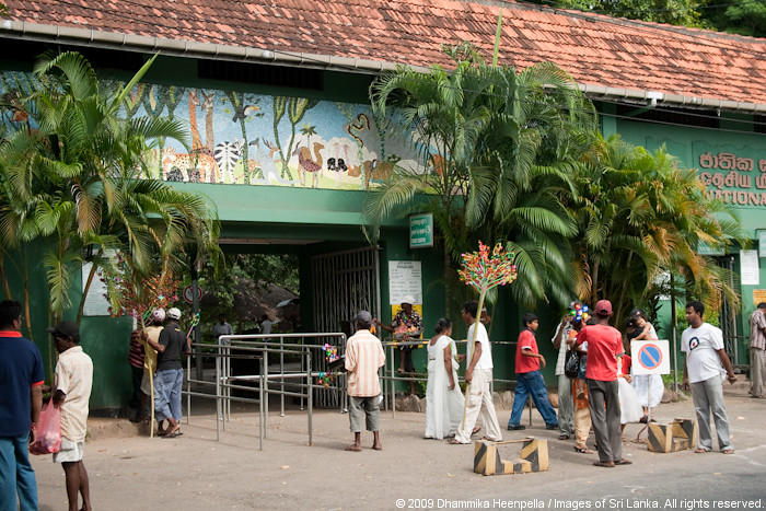 “National Zoological Gardens, Dehiwala” (CC BY-NC-ND 2.0) by Dhammika Heenpella
South of Colombo, the national zoo — over a century old, with the range of enclosures and welfare standards that implies. Improving in recent years but still not comparable to modern conservation zoos abroad. Family option on a rainy Colombo afternoon rather than a first-choice attraction.
Kelaniya Raja Maha Vihara
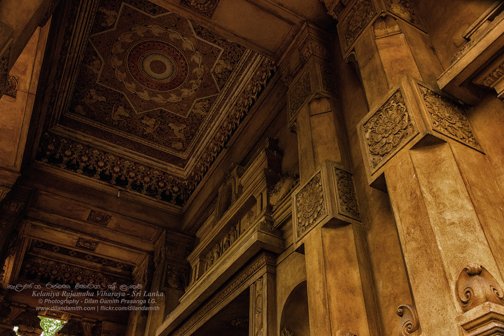 “Kelaniya Rajamaha Viharaya” (CC BY 2.0) by Dilan Damith Prasanga
A major Buddhist temple 10km northeast of Colombo, said in tradition to have been visited by the Buddha himself. Best known for the interior murals by Solias Mendis. The annual Duruthu Perahera (January) is the second-largest procession in Sri Lanka after Kandy’s Esala. Modest dress; shoes removed inside.
Pinnawala Elephant Orphanage
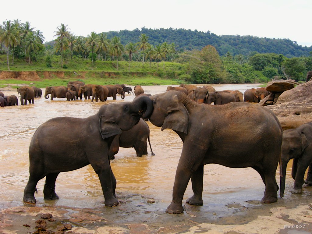 “Pinnawala Elephant Orphanage” (CC BY-NC-ND 2.0) by iris0327
A government-run captive-elephant facility between Colombo and Kandy, founded in 1975. Popular tourist stop for the daily river bathing procession. Note that “orphanage” is the historical name and its current welfare model — chained tethering outside bathing times, calf-riding at some times — is controversial; several conservation groups recommend against visiting. For a wild-elephant experience, Udawalawe, Minneriya or Kaudulla are better choices.
Panadura Beach
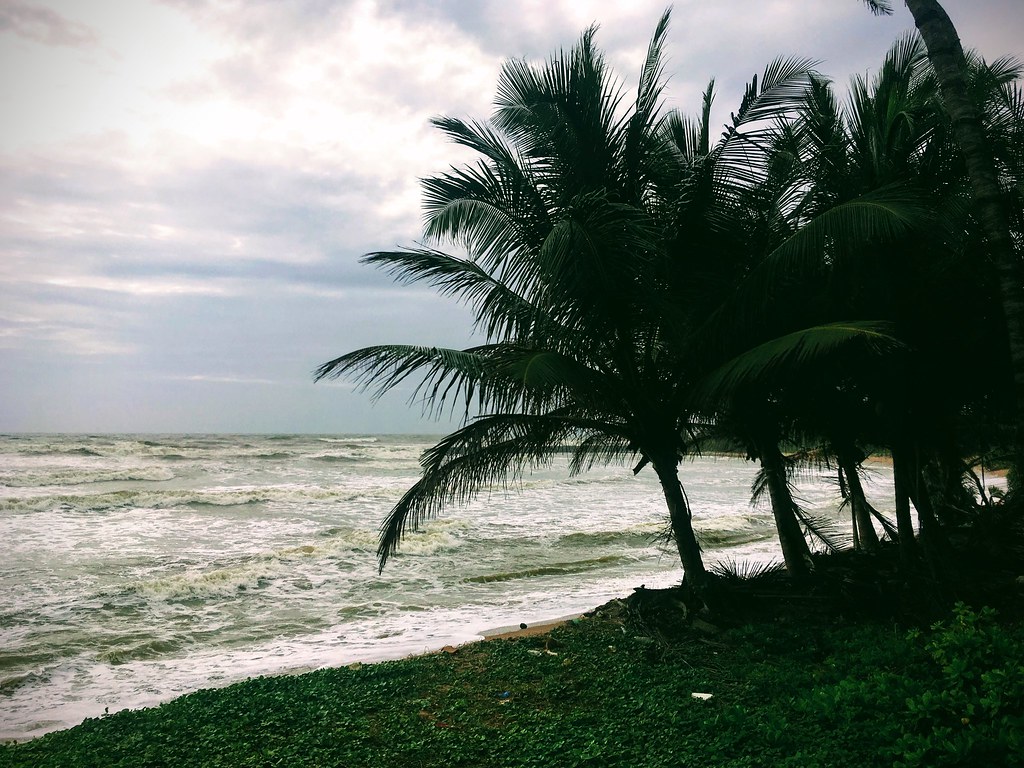 “Panadura beach” (CC BY-SA 2.0) by sergei.gussev
The first proper beach south of Colombo, ~25km down the Galle road. Long, wide, currents unsafe for casual swimming and a working fishing beach at both ends. Popular local weekend spot; less-visited than the resort beaches further south.
Moragalla Beach
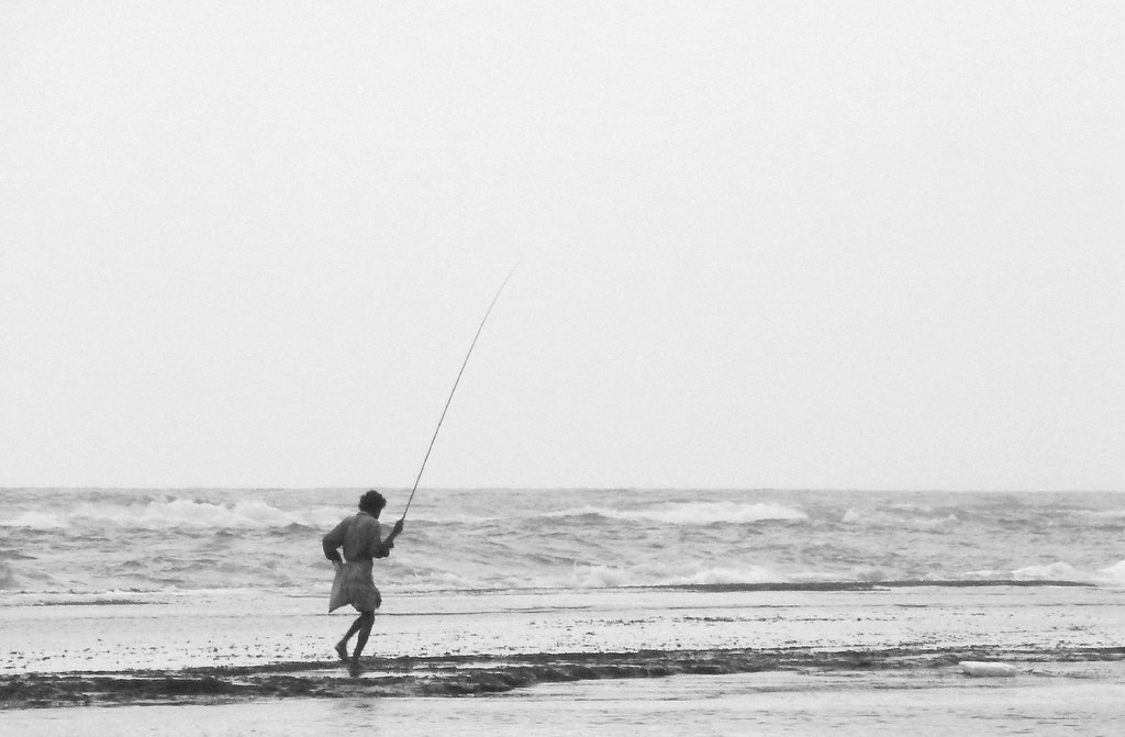 “Lone fisherman. Moragalla, Sri Lanka” (CC BY 2.0) by Jon Gudorf Photography
A quieter stretch of coast at Beruwala, north of Bentota. Calmer than the exposed beaches further south, popular with families and beginner swimmers in season. Several established resort hotels along the shoreline.
Bentota Beach
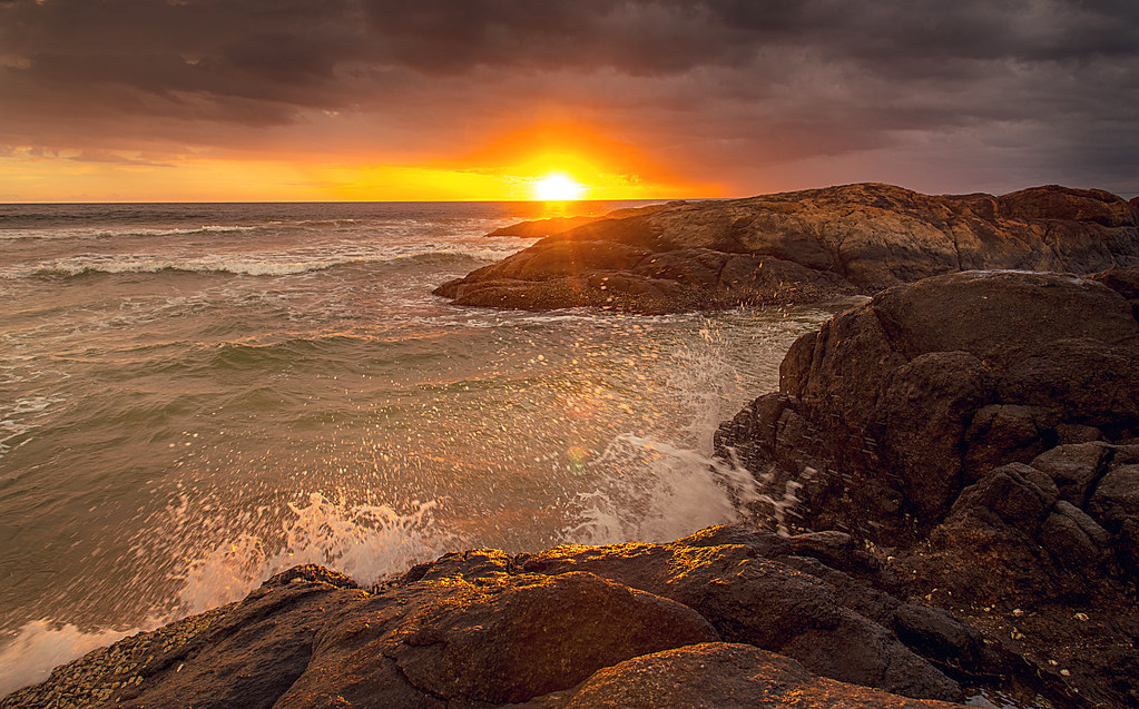 “Sunset at Bentota” (CC BY 2.0) by tataimitra
The classic west-coast resort beach, between the Bentota River and the sea. Established resort infrastructure, water sports on the river-mouth lagoon, and river safaris up the Madu Ganga into the mangroves. Peak season December through March; the SW monsoon (May–September) is the wet season here.
Kande Vihara
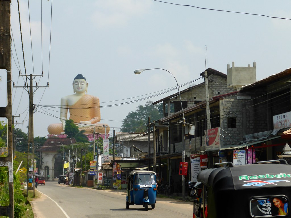 “Kande Vihara, Aluthgama” (CC BY-SA 2.0) by PercyGermany
A hilltop temple at Aluthgama with a 48-metre seated Buddha statue — one of the tallest in the world. Short walk up from the temple gates for a wide view over the west coast. Convenient add-on for anyone staying in the Bentota/Beruwala area.
Kosgoda Sea Turtle Hatchery
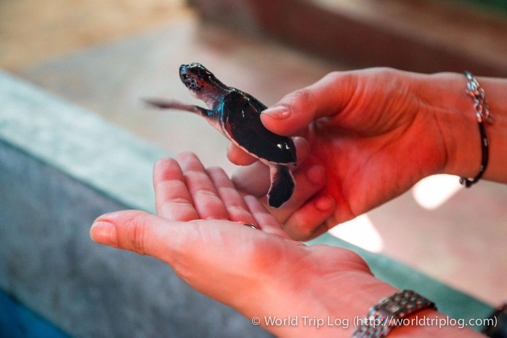 “Kosgoda Sea Turtle Hatchery” (CC BY-SA 2.0) by ctrlaltdileep
One of several turtle hatcheries along the SW coast, at Kosgoda between Bentota and Hikkaduwa. Rescues eggs from poached beaches, incubates them in protected sand and releases hatchlings at dusk. Practices vary between hatcheries — the better ones minimise handling and release quickly; others hold turtles in tanks for visitors, which conservationists criticise. Ask what happens after you leave before you buy a ticket.
Hikkaduwa Beach
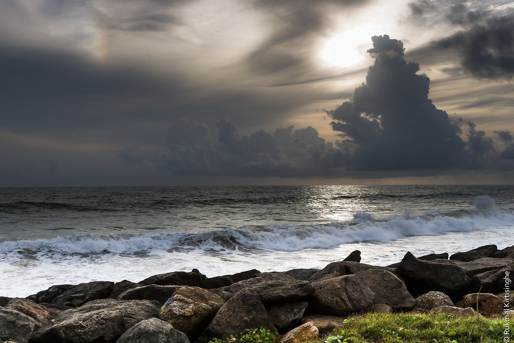 “Hikkaduwa beach” (CC BY 2.0) by rukmaldk
Sri Lanka’s original surf town, north of Galle. Reef break in front of the town beach, glass-bottom boats over the shallow coral, and the biggest party strip on the west coast. December–March for calm surf and clear water; April onwards for bigger waves and monsoon crowds thinning out. The 2004 tsunami hit here hard and the memorial is a short tuk-tuk south of town.
South coast: Galle to Yala
The south coast — from Galle around Dondra Head to Tissamaharama — is peak season December through March and wet during the SW monsoon (May–September). Palm-fringed bays, surf breaks, whale watching from Mirissa in season, and Yala at the far end.
Galle Dutch Fort
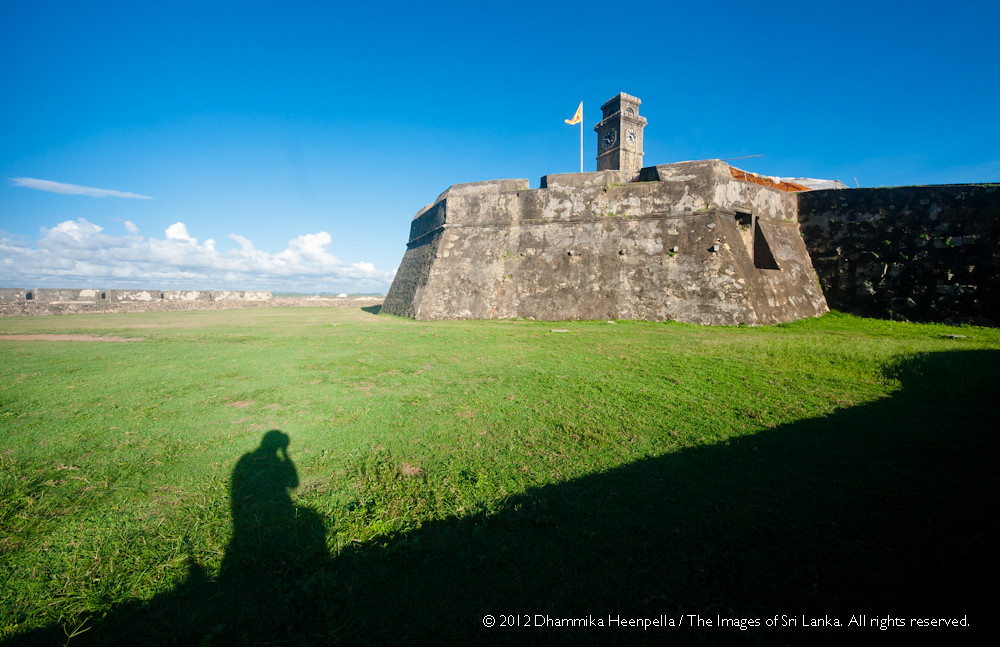 “Galle Fort” (CC BY-NC-ND 2.0) by Dhammika Heenpella
A 17th-century Dutch-built colonial fort still lived in, on a small peninsula at the south end of Galle Bay. UNESCO World Heritage. Boutique hotels in restored Dutch merchant houses; the ramparts do a 2km loop with the sea on three sides — the classic Galle sunset walk. Free to enter the fort; individual attractions inside carry their own tickets.
Galle Fort Lighthouse
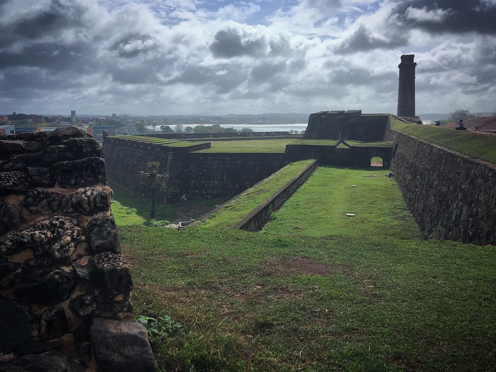 “Galle Fort” (CC BY-SA 2.0) by sergei.gussev
The white lighthouse at the seaward corner of the Fort — Sri Lanka’s oldest still in use (1848, rebuilt 1939). Not open to the public inside but the small beach and coconut palms at its base are the classic Galle photograph. Sunset crowds; go earlier for a quieter shot.
Unawatuna Beach
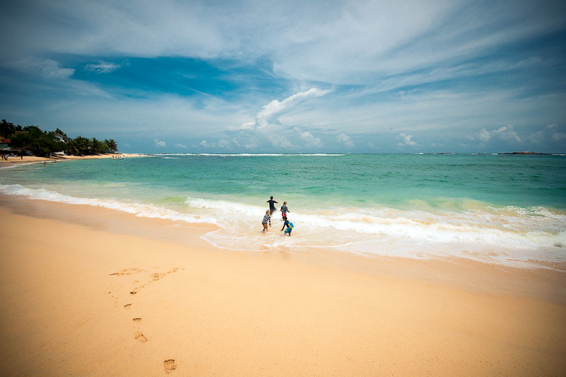 “Unawatuna Beach” (CC BY 2.0) by lola media
A crescent bay 5km east of Galle Fort — calm, swimmable water inside a small reef, and a strip of beach cafés and guesthouses. Densely developed compared with the beaches further east; still the standard “first beach after Galle” for most visitors. In-season only for calm swimming.
Jungle Beach
 “Unawatuna” (CC BY-SA 2.0) by sergei.gussev
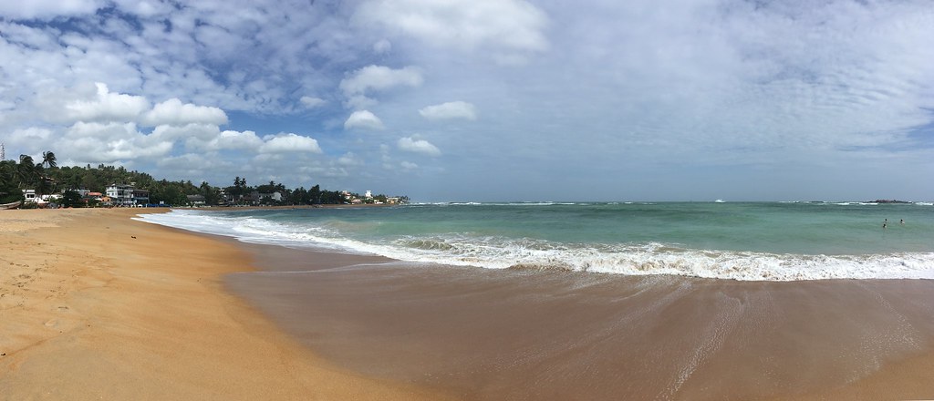
A small cove tucked behind Rumassala hill from Unawatuna, quieter than the main beach because the walk down puts most day visitors off. Reef snorkelling directly off the beach; a beach café with drinks. Twenty minutes on foot or a short tuk-tuk from Unawatuna.
Koggala Beach
 “Koggala beach” (CC BY-SA 2.0) by Cédric Z
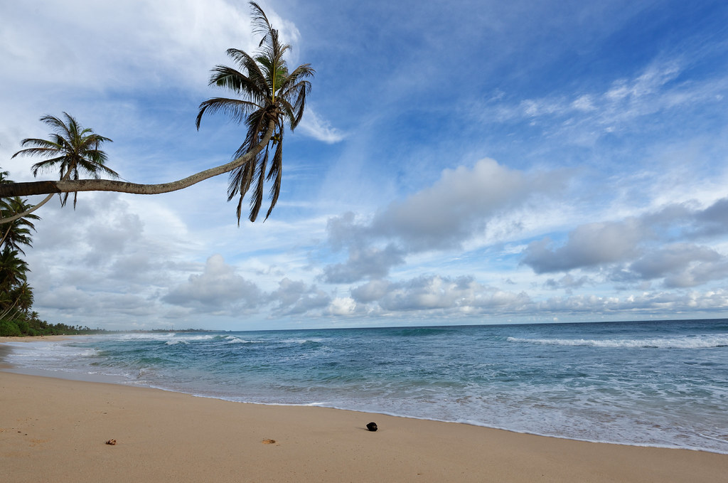
A long straight beach between Ahangama and Weligama, with the fishermen’s-house-turned-museum of Martin Wickramasinghe just inland. Wave-swept and open — used to be famous for stilt fishing, largely a staged photo activity now. Combine with a stop at the lake, the mask museum in Ambalangoda, and the beaches around Weligama.
Mirissa Beach
 “Mirissa Beach” (CC BY-SA 2.0) by samitriani
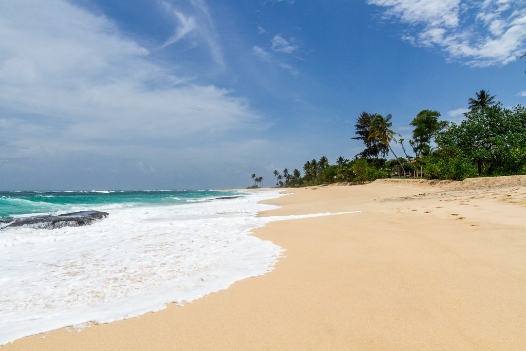
The best-known south-coast beach after Unawatuna and the base for the season’s blue-whale watching trips from November to April. Long crescent bay, restaurant strip along the shore, and a rocky headland at the east end. Book whale watching with an operator that follows the Sri Lanka Tourism guidelines for approach distance — cheaper boats routinely don’t.
Coconut Tree Hill
 “Coconut Tree Hill” (CC BY-NC 2.0) by Farah Yacoub
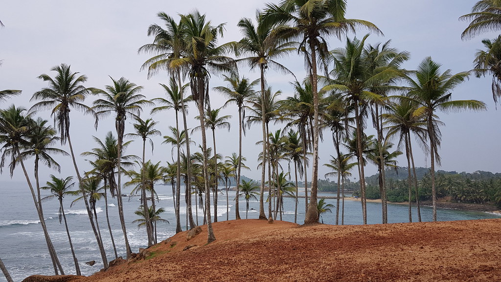
A small promontory at the east end of Mirissa town, planted with coconut palms and photographed as the “peninsula of palm trees over the ocean” that appears on every Sri Lanka social feed. Fifteen-minute walk from Mirissa beach. Sunrise for the light, sunset for the crowd, and it is crowded now.
Secret Beach Mirissa
Not so secret any more — signposted off the main road east of Mirissa. Small crescent of sand between two headlands, calmer than Mirissa proper, drinks and food from a couple of beach shacks. A ten-minute tuk-tuk from Mirissa.
Polhena Beach
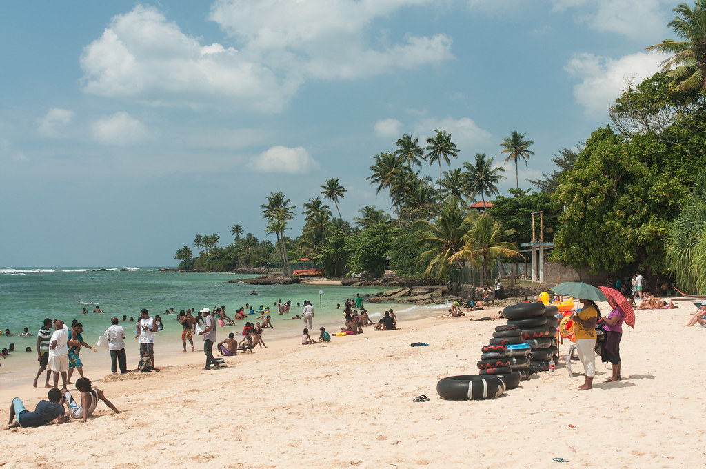 “Polhena Beach, Matara” (CC BY 2.0) by travelmag.com
At the western edge of Matara town, one of the calmer south-coast beaches thanks to a shallow reef that breaks the swell. Family-friendly swimming and snorkelling straight off the beach. Less developed than Mirissa; usually cheaper.
Dondra Lighthouse
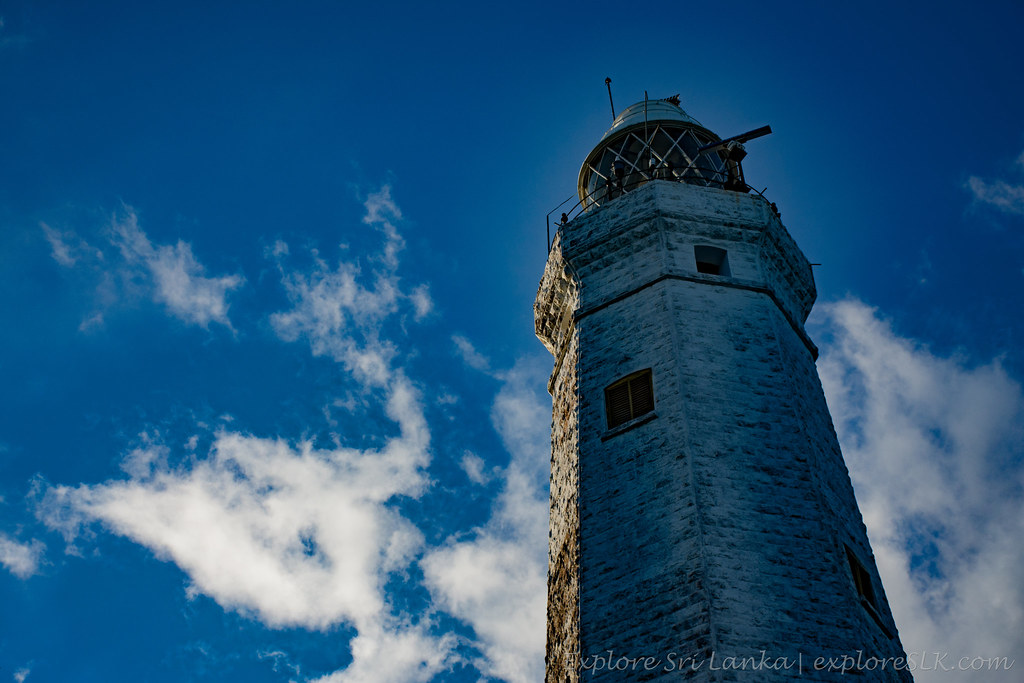 “Dondra Lighthouse” (CC BY-SA 2.0) by exploreslk
An 1890 lighthouse on Dondra Head — the southernmost point of Sri Lanka. Not open to visitors inside but the base is a well-signposted photo stop with a plaque marking the geography. Easily combined with the Vishnu Devalaya temple at Dondra town on the way through.
Hiriketiya Beach
A near-perfect horseshoe cove between Dickwella and Tangalle, with a small beach-break wave for beginner surfers on the west side and calmer swimming on the east. Now the busy end of the “off the beaten track” south coast — cafés, surf schools, boutique villas. Peak season December through March.
Bundala National Park
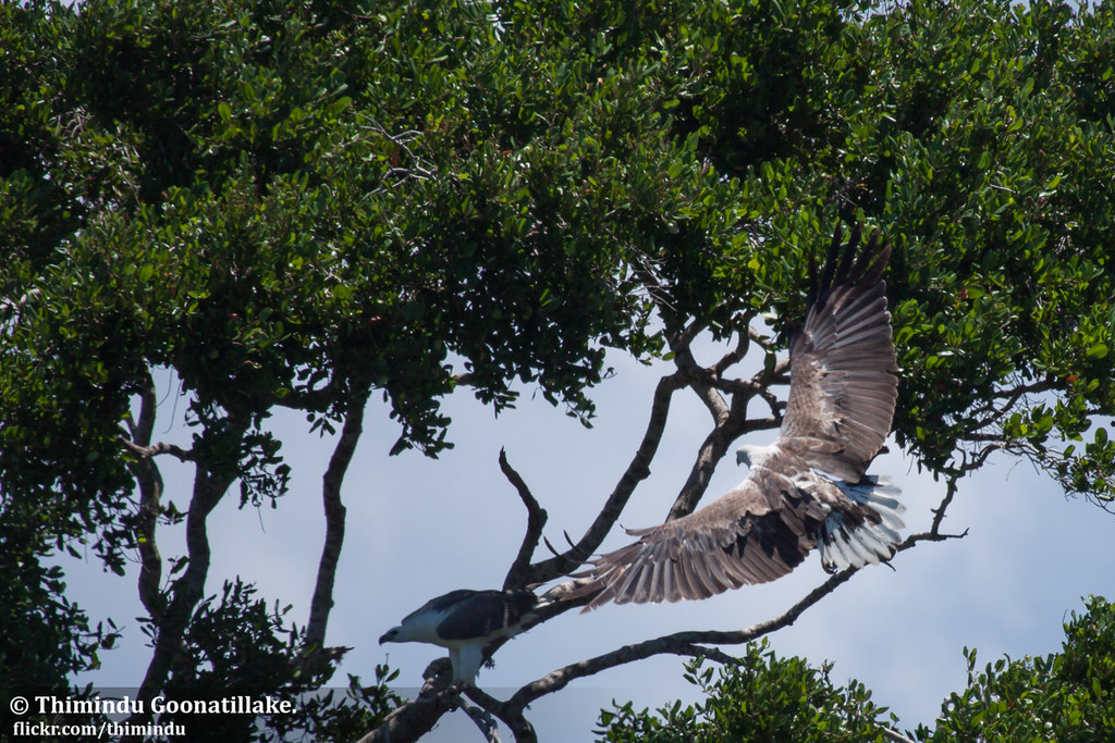 “Painted stork at Bundala” (CC BY-NC-ND 2.0) by Thimindu
A Ramsar-listed wetland park near Hambantota, world-class for waterbirds — flamingos, painted storks, pelicans and dozens of migratory species from September through April. Quieter than Yala for wildlife; better for birding specifically. Half-day 4WD safaris from Tissamaharama or Hambantota.
Yala National Park Safari
 “National park safari, Sri Lanka” (CC BY-SA 2.0) by GaurikaW
Sri Lanka’s most-visited national park, in the south-east near Tissamaharama. Highest leopard density in the country, plus elephants, sloth bears, crocodiles and endless birdlife. Peak visitor pressure has been a real issue at gate rushes — book a private half-day or full-day with a well-known operator, not a group jeep from the gate. Park closes in September for its annual maintenance period.
East coast: Trincomalee to Arugam Bay
The east coast is dry when the west is wet — peak season is roughly May through September. Trincomalee and the Nilaveli/Uppuveli beaches are the northern anchor; Arugam Bay is the southern surf destination.
Fort Frederick, Trincomalee
Seventeenth-century fortress built by the Portuguese and rebuilt by the Dutch and British, on the headland above Trincomalee harbour. Still an active army base — you walk through the gates, past the barracks, up to the Koneswaram temple at the seaward end. Free entry; ID may be checked at the gate.
Nilaveli Beach
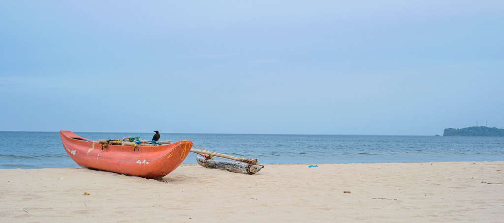 “Nilaveli Beach, Trinco” (CC BY 2.0) by mahasen
The long white-sand beach north of Trincomalee — quieter than Uppuveli, with a spread of low-rise resorts and cabana operations. Calm swimming in season (roughly April through September); largely closed and rough in the northeast monsoon. Boat launches for Pigeon Island from the beach.
Pigeon Island
A marine national park just off Nilaveli — two small coral islands with shallow reef, accessible by short boat trip. Good snorkelling straight off the beach: reef sharks, turtles, colourful reef fish. Limited visitor numbers per day; go early to get on an earlier boat. Peak season is the same as Nilaveli — roughly April through September.
Arugam Bay Beaches
The premier surf destination on the east coast, on the southeast corner of the island. A long right-hand point break (Main Point) plus outer breaks — season is May through September when the swell fires and the winds are offshore. Small town with surf schools, cafés and yoga; largely shuts down in the wet northeast-monsoon months.
Kumana National Park
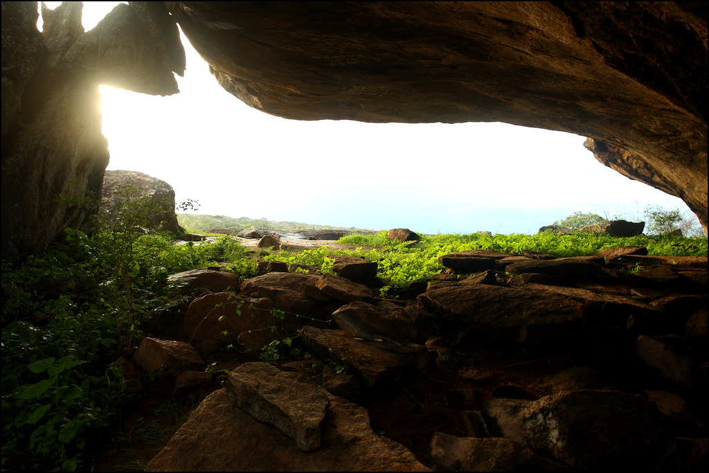 “Kumana National Park” (CC BY-SA 2.0) by GaurikaW
Yala’s eastern neighbour, accessed from Arugam Bay side — same landscape and wildlife (leopards, elephants, sloth bears), a fraction of the visitors. Also a major waterbird site, with the Kumana bird reserve at its heart. Half-day safaris from Panama near Arugam Bay.
Gal Oya National Park
Inland from Ampara, a park built around the Senanayake Samudraya reservoir — the only national park in Sri Lanka where safaris are run by boat rather than 4WD. Elephants swim between the islands in the reservoir when the water is high. Quiet, still off most itineraries, and one of the more distinctive safari experiences on the island.
Rainforest and other national parks
Sinharaja Forest Reserve
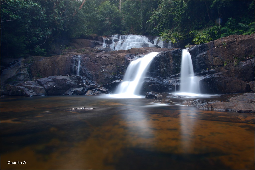 “Tattu Ella waterfall @ Sinharaja Forest Reserve” (CC BY-SA 2.0) by GaurikaW
Sri Lanka’s last major undisturbed lowland rainforest, UNESCO World Heritage. Endemic-heavy birding — over half of Sri Lanka’s endemic birds are found here — and dense biodiversity that rewards a guided walk. Entry through Kudawa, Pitadeniya or Deniyaya. Full-day guided walks are the standard; leeches are the standard companion.
Wilpattu National Park
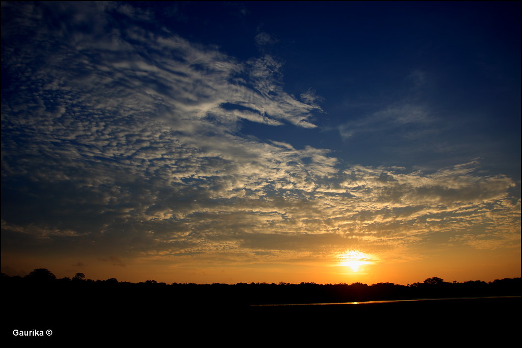 “Sunset at Wilpattu National Park” (CC BY-SA 2.0) by GaurikaW
The largest national park in the country, north of Puttalam. Landscape of “villus” — natural sand-rimmed lakes — dotting the dry forest. Leopards, elephants, sloth bears; feels wilder than Yala because far fewer vehicles are inside on any given day. Better in the dry months (February through October). Full-day safaris pay off here.
Udawalawe National Park
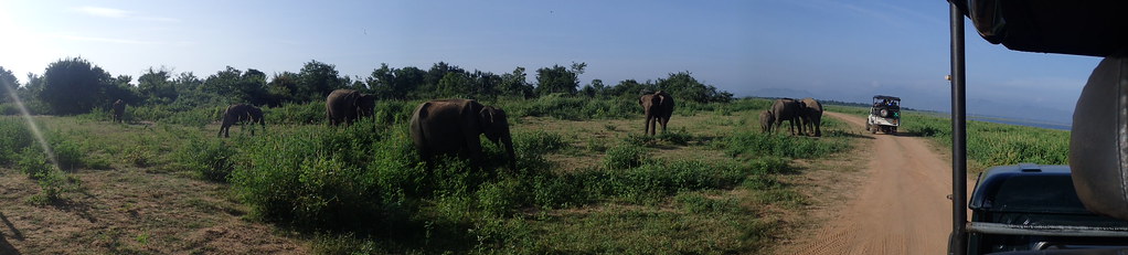 “Udawalawe National Park” (CC BY 2.0) by Jasmine Halki
The elephant park, between the south coast and the hill country. Consistent sightings of large herds year-round because the population is resident, not migratory. Adjacent Elephant Transit Home rehabilitates orphaned calves and releases them back into the park — public feedings are held daily. Better welfare model than Pinnawala.
About the dates and depth of these entries
The sketches above cover geography, what the site is, and the seasonal or logistical points a first-time visitor most often needs. They do not cover current entry fees, opening hours or transport schedules — those move too often to publish reliably at this scale. Where a destination charges an entry fee, it will be posted at the gate or on the site’s own current page; where a national park is on our list, check the park’s own opening notice for closure periods before you drive to the gate.
For decisions with a defensible “best-for” answer — comparison choices between hotels, ATMs, honeymoon regions by month, driving-permit procedure — see the focused Advice.lk guides linked at the top of this page.
FAQ
When is the best time to visit Sri Lanka?
It depends on which region. Broadly: December through March is the driest and most reliable season for the south coast, west coast, hill country and Cultural Triangle. May through September is the driest window on the east coast and the peak surf season at Arugam Bay. The inter-monsoon shoulder months (March–April, October–November) can go either way. See the “When to go” section above for the coast-by-coast pattern.
How is Sri Lanka divided into regions?
Administratively, Sri Lanka has nine provinces: Western, Central, Southern, Northern, Eastern, North Western, North Central, Uva and Sabaragamuwa. The capital Colombo is in the Western Province. Travellers usually think in terms of geographical regions (Cultural Triangle, hill country, south coast, east coast) rather than provincial boundaries — the two don’t map cleanly onto each other.
What is the currency of Sri Lanka?
The Sri Lankan rupee (LKR), divided into 100 cents in principle but coins under Rs. 1 are effectively out of circulation. Notes in current use are Rs. 20, 50, 100, 500, 1000, 5000; coins Rs. 1, 2, 5, 10. Exchange rates move — check a current source before you travel. For ATM access on foreign cards see the Best ATMs in Sri Lanka for tourists guide.
How long a trip do you need?
For a first visit trying to see the south coast, hill country and one of the Cultural Triangle sites — two weeks is a comfortable minimum. One week works if you commit to one region only (for example, Colombo + south coast, or Cultural Triangle + Kandy + hill country). Anything shorter than a week and internal-transit time starts eating the trip.
Is Sri Lanka safe to visit?
Sri Lanka has been broadly safe for tourists for years, with the standard urban precautions against pickpocketing in crowded markets and around bus stations. Solo travel is common. Check your government’s current travel advisory before booking, and — if driving — read the driving-permit and road-safety notes in the Advice.lk tourist driving permit guide.
What should I pack?
Light cotton clothing for the coast and lowlands; a light jumper or fleece for evenings in the hill country, which get cool at 2,000m. Cover-up clothing for temples (shoulders and knees). Sun protection year-round. Insect repellent for the parks and evenings. A basic waterproof jacket for the hills and the inter-monsoon shoulder months. Modest footwear that can come off quickly at temple entrances.


